Extensión JCRS (gestión de Sistemas de Referencia de Coordenadas)
Introducción
The JCRS extension aims to enable gvSIG to accurately manage Coordinate Reference Systems and coordinate operations. In addition, information has been incorporated regarding standard CRS repositories and operations, such as EPSG and IAU2000, which are the only ones available in this initial version.
These additions provide a solution to the problem of the ED50 – ETRS89 transition.
Furthermore, the two official IGN solutions have also been included:
- Through the EPSG, the various official IGN solutions concerning seven-parameter transformations have been introduced.
- Through Proj4, the official IGN transformation has been incorporated with a NTv2 grid file.
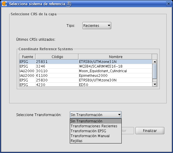
Selección sistema de referencia
In gvSIG, the CRS associated with a view by default can be determined when the view is created. To do so, open the gvSIG preferences dialogue box from the “Window/Preferences” menu or click on the corresponding button in the tool bar:

Select the “View” menu from the pull-down tree menu on the left-hand side of the window. The following window appears:
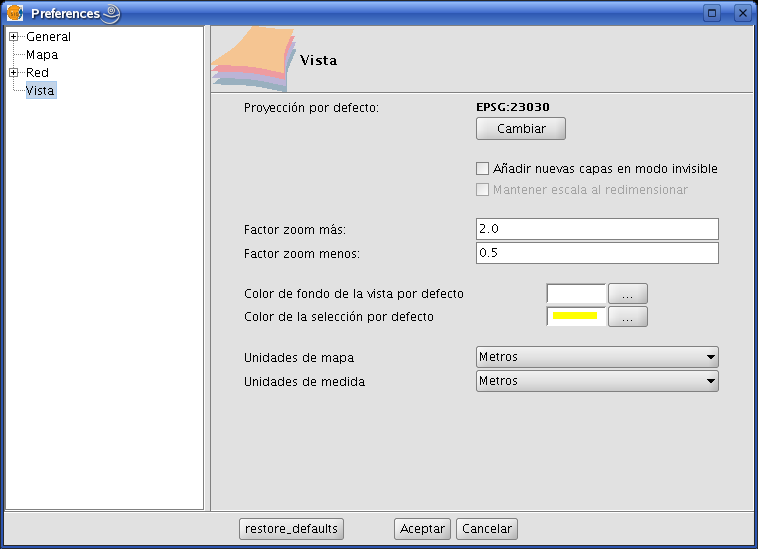
In the “Default project” section, clicking on the “Change” button will open the dialogue box to search for and select CRSs:
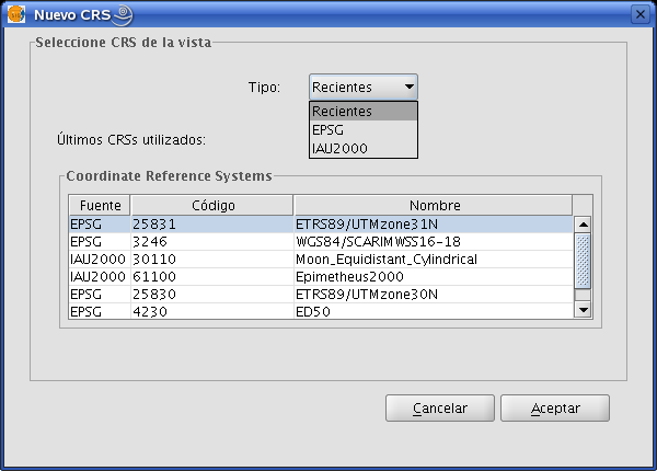
This box allows you to choose between three possible CRS repositories:
- Recent: The CRSs which have been used previously are displayed (Figure 2). The list of recent CRSs is available during current and future gvSIG sessions but it is not associated with any particular project.
- EPSG: This allows CRSs to be searched for and selected from the EPSG database (European Petroleum Survey Group).
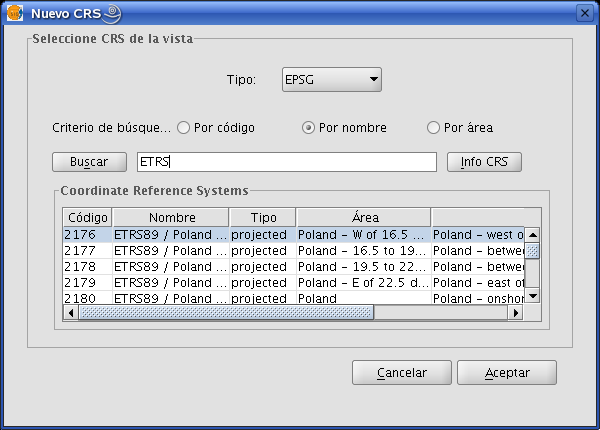
In order to perform a search, write the name of the CRS you wish to find in the corresponding text box. The following search criteria can be used:
- EPSG Code (e.g. 4230)
- CRS name (e.g. ETRS89)
- Area of application (e.g. Spain)
To change the search criteria, select the corresponding check box.
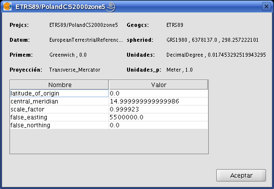
The “CRS Info” button provides detailed information about the CRS selected in the table at that time.
- IAU2000: This allows the user to search for and select CRSs from the IAU2000 database.
Clicking on the corresponding check box allows searches to be made “By code” or “By name”.
Establecer el CRS de una vista
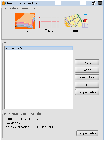
In order to set the CRS associated with a view, select the view in the gvSIG Project Manager and click on “Properties”.
In the “View properties” box, click on the “Current projection” button.
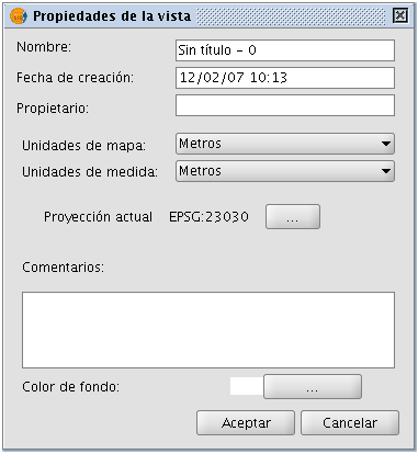
The CRS search box will open.

Seleccionar el CRS asociado a una capa
A layer’s CRS can be selected when the layer is added to the view. In the “Add layer” text box, click on “Current projection”.
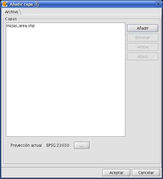
A box will open which is similar to the one used to select the view’s CRS, the difference being that there is a pull-down menu to select the transformation to be applied when reproducing the layer on the view (if this is required).
Transformaciones
Introducción
Changing a layer’s reference system requires a conversion or transformation operation, or a conversion and transformation operation:
- A coordinate conversion operation is applied when the layer’s CRS datum coincides with the view’s CRS datum. In other words, both CRSs correspond to the same geodesic reference system but use different coordinate systems.
In this case, the “No transformation” option would be selected.
- A coordinate transformation operation is applied when the layer’s CRS datum does not coincide with the view’s CRS datum. In this case, two types of coordinate operations can be carried out:
- The operation may only involve a transformation operation. This is the case when the layer’s CRS coordinate system coincides with the view’s CRS coordinate system, that is to say that the position is expressed in the same coordinate system in both CRSs but using different datum.
- The operation may require a joint transformation and conversion operation because neither the datum nor the coordinate system of the layer’s CRS and the view’s CRS coincide.
If such a transformation operation is required, select the type of transformation in the layer’s CRS’ selection box and click on “Next”. This opens the corresponding transformation panel.
There are three types of transformations: “EPSG transformation”, “Manual transformation” and “Transformation by grid file”.
Transformacion EPSG
These are the official seven-parameter transformation operations defined in the EPSG repository and are used when the view’s and the layer’s CRS belong to this repository. The panel for this type of transformation shows the transformations which can be applied. The source CRS is taken to be the one chosen for the layer and the target CRS is the one set in the view.
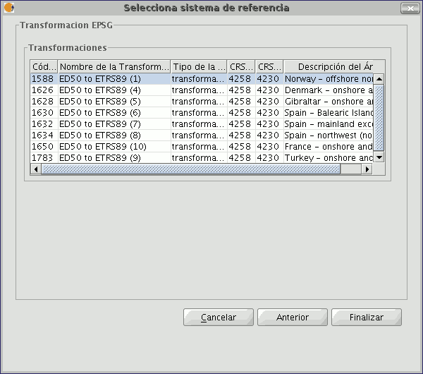
It must be taken into account that transformation operations of this kind are always carried out on base CRSs, that is to say non-projected CRSs. Consequently, if the CRS of the view or the layer is projected, the corresponding CRS base will appear in the CRS source and CRS target fields.
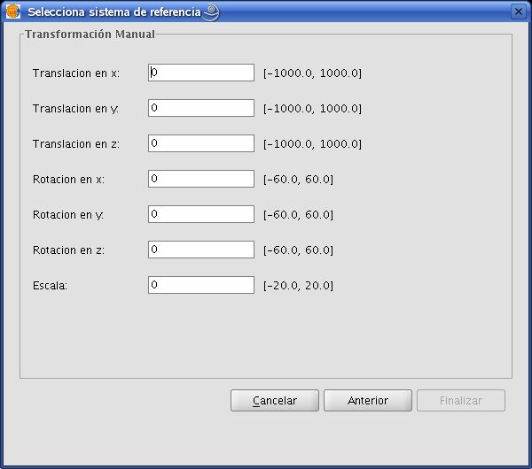
Transformación Manual
In this case, the transformation operation is defined by introducing seven parameters; the translation of “x”, “y”, “z”, the rotation of “x”, “y”, “z” and the scale.
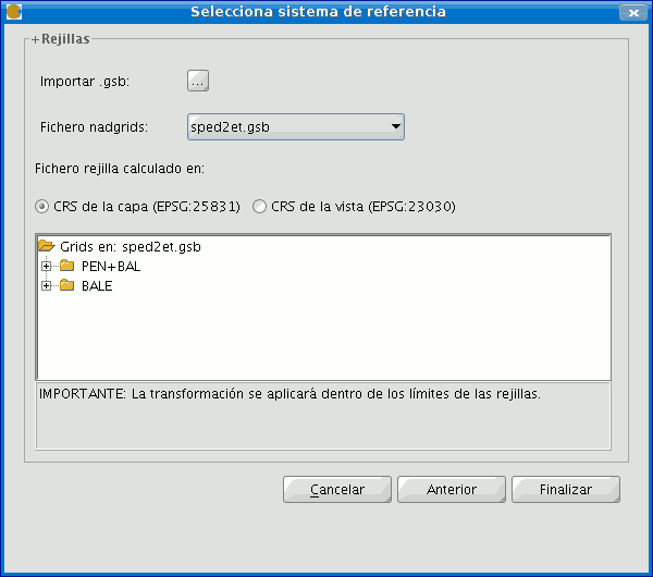
Transformación por fichero Rejilla
This involves carrying out a transformation operation based on an NTv2 grid file.
Select the file you wish to use from the ones available by clicking on the “Nadgrids file” pull-down menu.
If you wish to use any other NTv2 file, it must first be imported. To import a “nadgrids” file, click on the “Import .gsb” button. This then opens the list of files which can be used for the transformation.
Grid files are calculated for a specific CRS and this data must be provided by checking one of the two options under the “Grid file calculated on:” label.
NB: A grid file has a specific area of application which can be seen in the information about this file in the transformation panel. No transformations are performed outside this area. As a result, the reprojection is considerably less accurate as it simply carries out the corresponding conversion operation between coordinate systems.
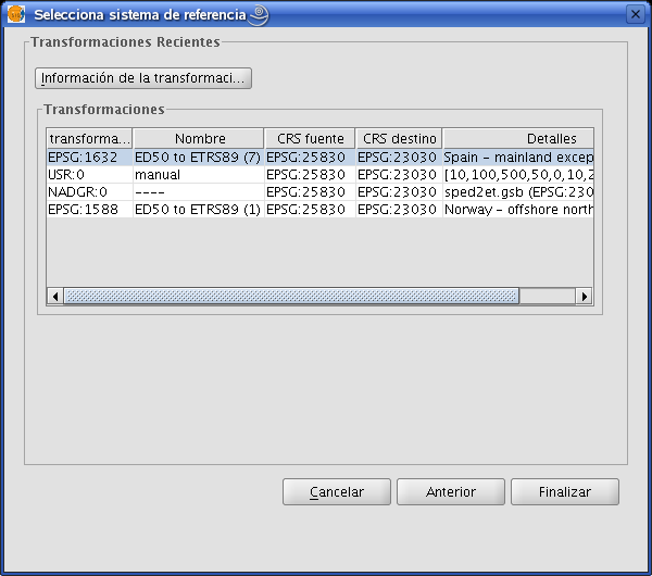
Recent transformations This function allows a previously-used transformation to be selected. The list of recent transformations is available in current and subsequent gvSIG sessions and is not linked to a specific project.